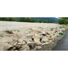
Changes in the level and volume of water in rivers, lakes and swamps over time. It is characterized by a daily, annual and secular rhythm.
There are the following phases of the water regime: high water, floods, low water, ice, ice drift.
Flood is a relatively long increase in the water content of the river, repeated annually in the same season, causing the water level to rise; it is usually accompanied by the release of water from the tidal channel and flooding of the floodplain.
A flood is a relatively short-term and non-periodic rise in water level caused by the rapid melting of snow during thaw, glaciers, heavy rainfall. Successive floods may form a flood. Significant high water may cause flooding.
The low-water mark is an annual, seasonal period of low (low) water levels in rivers. It is usually defined as a period of at least 10 days of low water, caused by dry or frosty weather, when the water content of the river is maintained mainly by groundwater recharge, with a sharp reduction or cessation of surface runoff. In temperate and high latitudes, there are summer (or summer-autumn) and winter seasons.
Freezing is a period when there is a stationary ice cover on a watercourse or reservoir. The duration of the freeze depends on the length and temperature regime of the winter, the nature of the reservoir and the thickness of the snow.
Ice drift - movement of ice floes and ice fields on rivers.
The uneven flow of rivers throughout the year is related to uneven precipitation, melting of snow and ice and the flow of their waters into rivers.
Fluctuations in water levels are mainly caused by changes in water flow, but also by the action of wind, ice formations and human economic activity.
Typical river flow regimes vary between climatic zones:
The equatorial belt - rivers are full of water all year round, with a slight increase in autumn run-off; surface run-off is exclusively rain-fed.
Tropical savannah - water content is proportional to the duration of the wet and dry seasons; predominance of rain-fed vegetation, with flooding lasting 6-9 months in the wet savannah and up to three months in the dry savannah; fairly significant summer runoff.
Mediterranean-type subtropics - medium and low water content, winter runoff predominant.
Oceanic subtropics (Florida, the lower reaches of the Yangtze) and adjacent areas of south-east Asia - the regime is determined by the monsoon, with the highest water content in summer and the lowest in winter.
The temperate zone of the northern hemisphere - increased water availability in spring (in the south mainly due to rain nutrition; in the central zone and in the north - a flood of snow origin with more or less stable summer and winter autumn).
The temperate zone in a strongly continental climate (northern Caspian Sea and lowland Kazakhstan) - a short-term spring flood when the rivers dry up for most of the year.
The Far East - the regime is determined by monsoons, summer floods of rain origin.
Permafrost areas - drying up of rivers in winter. Some rivers in eastern Siberia and the Urals form ice when they freeze. In the sub-Arctic, the melting of the snow cover is late, so that the spring flood extends into the summer. On the polar cap glaciers of Antarctica and Greenland, ablation processes occur in narrow peripheral bands, within which peculiar rivers form in ice beds. They feed exclusively on glacial water during the short summer.
Water regimen
Tags: Water regimen

