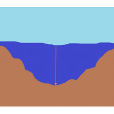
Maximum depth - vertical distance from the water surface in a river, lake, etc. to the bottom. Determined directly from the results of actual measurements of the lake.
The measurement is a set of actions to measure the depth. The purpose of the measurement is to determine the bottom topography and the nature of the ground. Depth measurement in coastal waters is performed by hand trawl from dinghies, and the measurement itself is called a dinghy measurement. In ship-based measurements in areas away from the shore, depths are measured with mechanical boats or echo sounders. The distance between the measuring transects, i.e. lines along which the depths are measured, varies from 5 to 200 fathoms for the boat survey and from 50 fathoms to 1 mile for the ship survey, depending on the details of the survey.
Maximum depth
Tags: maximum depth

